Contact
Department of Aquatic Sciences and Assessment, Division of Ecology and Biodiversity

The part of the landscape that connects watercourses and surrounding land is highly interesting from several perspectives. Here there are strong interests that do not always manage to agree. Now there is help for this: a model that provides support when planning the riparian zones.
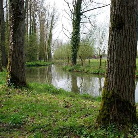
Riparian zones connect watercourses and surrounding land. On the one hand, this type of land is good for agriculture and grazing, and at the same time it is highly valued for recreation and it is important for biodiversity. Satisfying all these interests on the relatively small surface is a tough task, which is the starting point of a study carried out under the direction of Brendan McKie, Department of Water and Assessment, SLU.
The results of the model that the researchers developed in this study show that it is possible to satisfy several interests with a few minor measures.
The study shows that the areas where the watercourses have their source are preferred for planting forests. In addition, there should be a network of "forest patches" further downstream, to build up a good network of woody riparian zones across the catchment. Together, both these strategies lead to improved ecological status..
There are several reasons why headwaters are preferred for forestation, partly because they are often located in the parts of the catchment that are less environmentally affected, and partly because it is more efficient to build on existing biodiversity rather than starting from scratch. When planning, it is important to take into account which measures are most effective:
- When land use is low, the buffers are effective, when land use is high, the buffers are less effective, says Brendan. How effective an action is important to stakeholders who often want to know what kind of consequence they can count on when an action is carried out. What is happening in the landscape? Do I get value for my investment?
All of the combined benefits of wooded riparian zones led the researchers involved in the study to use tree replanting as the main and preferred management measure in their model. At the same time, the researchers point out that there are more factors affecting water quality that should be taken into account. This could be factors such as dams or sewage flowing into the watercourse.
A wooded shoreline has several positive effects. On the one hand, it provides greater recreational value, is good for water quality, and is good for biological diversity.
Trees provide shade that leads to a lower and more stable water temperature, which is important for many aquatic organisms and thus increases the possibility of biodiversity. Forests also contribute to diversity in the ecosystem because as material from the trees (for example leaves) becomes both a resource and a habitat. Trees also help restructure the soil through their root systems.
When riparian zones have trees, they provide cumulative benefits through better connectivity with other parts of the watercourse's corridor and the areas it flows through. Vegetation has a more direct impact on a small watercourse compared to a larger one because the effect is dependent on relative size, as trees can shade the entire watercourse if it is a stream rather than a river.
That the study takes several spatial scales into account is central. The reason for taking the several spatial scales into account is that ecosystems are interconnected. This is something that is particularly clear in the case of watercourses due to their long, narrow nature, which connects parts at the beginning of the watercourse with those closest to the sea. At the same time, that smaller stretches can be considered individually.
The connection of ecosystems and the different scales also provides the solution for the model developed by the researchers. The model is able to point out different scenarios for what happens if trees are planted along a watercourse. This type of scenario analysis does not usually have the type of societal considerations that are included in the study Brendan led.
The predictive model in the study is not meant to be a sole decision basis for land use planning, but an aid for local decisions that have regional consequences.
To build the model and then be able to check it, the researchers have used four indicators: EPT index for checking the ecological status, FD index for functional biodiversity, checking the decomposition of organic matter, and GIS data showing soil fertility. The first three indicators are based on data from samples taken along the watercourse Zwalm in Belgium which is an example of the model.
- Although we had the ambition to test the analysis in the five countries that are part of our project CROSSLINK, we ended up only doing it at the Belgian watercourse because it was the only one with sufficient data for land use, says Brendan. I still think that the general principle of what this model shows and the conclusions we were able to draw, can actually be applied in most places.
Witing, F., et.al. (2022). Riparian reforestation on the landscape scale – Navigating trade‐offs among agricultural production, ecosystem functioning and biodiversity, Journal of Applied Ecology, Vol. 59, Issue 6, pp. 1456-1471.